
The short version
The Cape Cod Area Wide Water Quality Management Plan Update, usually called the “208 Plan,” is the regional blueprint for fixing the Cape’s nitrogen problem. The state directed the Cape Cod Commission to update the original 1978 plan, and this version was certified by the governor and approved by the US EPA in 2015. It names septic systems as the largest source of nitrogen we can control. It calls for solving the problem one watershed at a time, across town lines, with a mix of sewers and lower-cost alternatives. It also estimates that this approach could cut the Cape-wide cost by billions of dollars.
What the researchers did
In January 2013, the Massachusetts Department of Environmental Protection directed the Commission to update the plan under Section 208 of the federal Clean Water Act. The Commission ran a large public process and technical review over about two years.
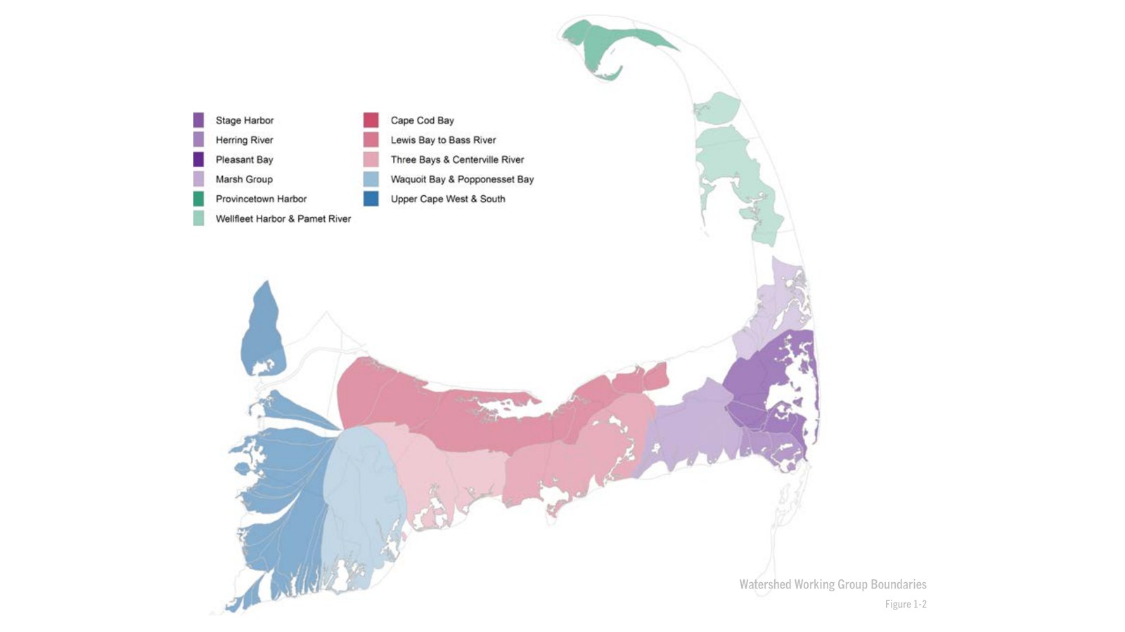
- About 170 stakeholders took part in watershed working groups, along with subregional meetings, Cape-wide summits and an online game that drew more than 900 players.
- The Commission cataloged 67 technologies and approaches in 10 categories, from sewers and nitrogen-reducing septic systems to shellfish farming, permeable reactive barriers and inlet widening, in a “Technologies Matrix.”
- Two teams worked out “traditional” sewer-based and “non-traditional” scenarios for each embayment watershed, using new mapping and nitrogen-loading tools such as WatershedMVP.
What they found
- Septic systems are the main problem. About 80% of the nitrogen entering Cape Cod’s watersheds comes from septic systems. On average, the state’s cleanup targets require removing more than half of the septic nitrogen Cape-wide.
- Watersheds cross town lines. The Cape has 53 watersheds draining to coastal embayments, covering nearly 79% of its land. Of those 53, 32 are shared by more than one town.
- Results take time. Groundwater can take up to 100 years to reach a bay, but less than 10 years across almost half the region. Once treatment is in place, the plan says some embayments could improve within 5–10 years.
- Cost is the main barrier. More than 30% of Cape housing is seasonal, and the Cape has less than 4% of the state’s population but 20% of its Title 5 septic systems. Plans for just six towns would have cost $100 million to $700 million each, over $2 billion in all, and removed less than half the nitrogen needed.
- A targeted mix could save billions. Earlier estimates put Cape-wide source reduction at $4.2 billion to $6.2 billion. The plan estimates that a mix of reduction, remediation and restoration strategies could meet water quality goals for $2 billion to $3.8 billion. Orleans estimated a 40% savings by following this approach.
- Doing nothing has a price. A study in Barnstable’s Three Bays found that each 1% rise in nitrogen was linked to an average 0.61% drop in nearby home sale prices.
What it means for Waquoit Bay today
The 208 Plan is the framework behind Falmouth’s and Mashpee’s current wastewater planning for Waquoit Bay. It made each Cape town responsible for water quality planning, urged neighboring towns to share responsibility for watersheds that cross town lines, and opened the door to watershed permits and to alternatives such as nitrogen-reducing septic systems and shellfish. Waquoit Bay is exactly the kind of shared watershed the plan has in mind. In 2017, it was named one of 11 priority watersheds for implementation (see our summary of the 2021 progress report).
The plan is blunt about the stakes. It opens by saying Cape Cod has a water problem
(Cape Cod Commission, 2015), and its conclusion warns that the region is moving in the wrong direction. For residents, it’s a reminder that the targets in the state’s threshold report are real and that cost, not science, has been the main obstacle.
Read the report
Cape Cod Commission. (2015). Cape Cod Area Wide Water Quality Management Plan Update. Barnstable, MA: Cape Cod Commission, June 15, 2015. No DOI. Official copy: capecodcommission.org.
License: Published by the Cape Cod Commission, a Barnstable County agency. No open license is stated, so we link to the Commission’s official copy rather than hosting it here. Appendices are on the Commission’s 208 Plan page. The card image is Figure 1-2 from the plan, the Commission’s own map of watershed working group boundaries.
Drafted with AI assistance from the linked source.


