
The short version
Each year the Cape Cod Commission reports to the US EPA on how towns and the region are carrying out the 2015 Section 208 Plan to clean up the Cape’s bays. This June 2021 report covers July 2020 to June 2021, a year slowed by the COVID-19 pandemic. It describes a new regional fund that awarded over $71 million to help towns pay for water quality projects, progress on agreements between towns that share watersheds, and a new regional water quality database. Waquoit Bay was chosen as the pilot watershed for that database.
What the researchers did
This is a progress report rather than a scientific study. The EPA requested it to assess how the 208 Plan’s recommendations are being put into practice.
- It summarizes the status of state nitrogen studies and limits (TMDLs) for each Cape embayment.
- It reports on the 11 priority watersheds named in 2017, including Waquoit Bay.
- It tracks the plan’s four groups of recommendations: information, support for towns, regulatory reform and cost. Draft compliance reports for each town were attached.
What they found
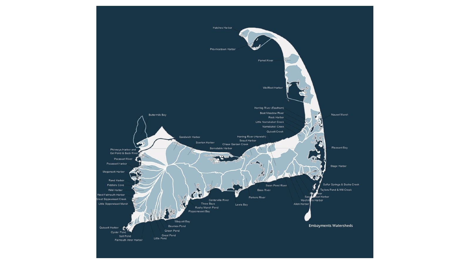
- The scale of the problem. Of 53 Cape embayments susceptible to nitrogen, 34 need nitrogen reductions and 30 have state nitrogen limits. For Waquoit Bay, limits are in place for Eel Pond, the Quashnet River, Hamblin Pond and Jehu Pond.
- New money is flowing. The Cape Cod and Islands Water Protection Fund, paid for by a tax on short-term rentals, collected about $22.9 million from July 2019 through May 2021. In April 2021 its board approved over $71 million in subsidies, including almost $55 million for 15 projects in seven towns.
- Towns are working together, slowly. Agreements had been signed for Popponesset Bay and Pleasant Bay, and discussion of a Waquoit Bay agreement had begun. No new agreements were signed during this reporting year.
- Waquoit Bay as a data pilot. A new regional database, with data from 1993 to 2018, was piloted in Waquoit Bay with Falmouth, Mashpee and the Waquoit Bay Reserve. One question it is being used to explore is whether water quality changes near town oyster and quahog propagation sites.
- Alternatives are being tested. Projects included a permeable reactive barrier in Falmouth’s Great Pond watershed, expected to remove upwards of 530 kg of nitrogen a year, and nitrogen-reducing septic systems in Barnstable’s Three Bays watershed. A working group also began studying how towns could manage large numbers of such systems.
What it means for Waquoit Bay today
This report is a snapshot of the machinery behind Waquoit Bay’s cleanup in 2021: limits in place, a priority-watershed designation, new subsidies to ease costs, and a regional database being tested here first. It also shows how slowly multi-town agreements move. The Waquoit Bay agreement was still at the discussion stage, and talks on shared wastewater treatment at Joint Base Cape Cod had largely paused while the future operation of the base’s treatment plant was worked out. The Commission notes the burden of cost should not fall solely on year-round residents
(Cape Cod Commission, 2021).
For residents, the most useful takeaway may be the water quality portal, which makes decades of monitoring data publicly available. That data will be central to judging whether the towns’ plans are working. For the regional framework this report tracks, see our summary of the 2015 Section 208 Plan; one of the septic projects mentioned is described in our post on the Barnstable woodchip septic test.
Read the report
Cape Cod Commission. (2021). Cape Cod 208 Plan Implementation: 2021 Report to the United States Environmental Protection Agency. Barnstable, MA: Cape Cod Commission, June 2021. No DOI. Official copy: capecodcommission.org.
License: Published by the Cape Cod Commission, a Barnstable County agency. No open license is stated, so we link to the Commission’s official copy rather than hosting it here. The card image is the embayment watersheds map from page 4 of the report, the Commission’s own map.
Drafted with AI assistance from the linked source.


